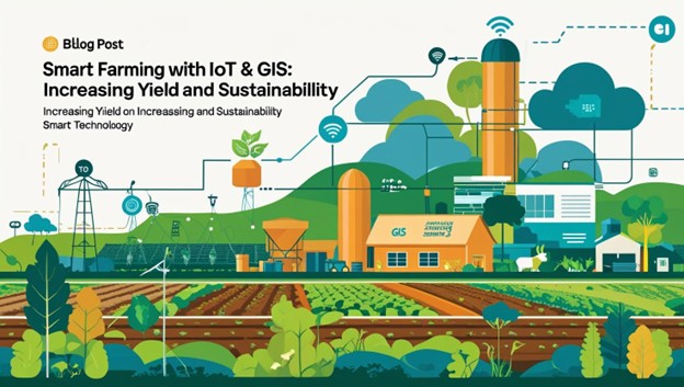
In recent years, there has been a revolutionary change in the agriculture sector, affected by the progress in technology. In these innovations, smart farming with IoT and GIS stands out as a powerful combination that we produce food. With increasing concerns over climate change, soil fall and population growth, the need for permanent agricultural-technical solutions has never been more important. This blog explains how the integration of IoT in agriculture and GIS-based farm monitoring is enabling accurate farming tools to maximize crop productivity, ensuring environmental stability.
Introduction to smart farming
Smart farming refers to the application of modern information and communication technologies in agriculture. Its purpose is to increase the amount and quality of agricultural production by making farming more accurate and controlled. The use of smart farming with IoT and GIS is at the center of this innovation, allowing farmers to make data-operated decisions and to automatically to automatically cultivate various aspects of farming.
The Internet of Things (IoT) connects physical equipment such as sensors, drones and weather stations to the Internet, collects real -time figures on soil moisture, temperature, humidity, crop health, and more. Geographical Information System (GIS) adds a spatial dimension to this data, which enables agarigis mapping solutions that help imagine patterns and trends in areas.
IoT role in agriculture
IoT in agriculture has emerged as one of the most transformative forces in modern farming. By enabling real -time monitoring, automated decision making and future stating analysis, IoT technology greatly improves operating efficiency and agricultural productivity. The integration of IoT devices in agriculture includes a variety of equipment and systems such as smart sensors, weather stations, unmanned air vehicles (UAVs), and GPS-equipped equipment, all are working together to streamline the farm management.
One of the most prominent applications of IoT is in smart irrigation systems. Soil moisture sensors placed in different parts of the region can detect water content in the soil and communicate with a central control system. This system actually determines when and how much irrigation, which leads to significant water conservation and optimal plant development. These systems not only reduce water waste, but also ensure that crops receive an accurate amount of hydration required for maximum yield.
Another valuable application is to detect automatic insects and disease. The IoT-based monitoring system uses high-resolution cameras and image recognition algorithms to detect pest infection or early signs of crop disease. These alerts help farmers take preventive measures before increasing problems, which reduces dependence on chemical pesticides and increases crop health.
Temperature and humidity sensors are widely used in greenhouse automation. These sensors collect data and control systems to regulate environmental conditions such as heating, cooling, ventilation and lighting. It creates a stable and optimal microclimate, which leads to crop growth and high yields.
Role of IoT in Livestock:
IoT devices also play an important role in the supervision of livestock. IoT equipment wearing on animals track their health, location and behavior. If an animal is sick, injured or in crisis, farmers receive real -time alerts. This provides quick intervention and improves animal welfare.
Farmers can use integrated drone technology with IoT for air monitoring of fields. Drone crops equipped with multisectoral sensors can monitor health, identify areas with drought or nutrient deficiency, and evaluate plant growth in large areas. Captured data in real time is sent to cloud-based platforms, where it is analyzed and conceived for actionable insight.
In addition, the future analysis operated by IoT devices can predict weather patterns, disease outbreaks and insect invasions. It enables better preparation and casual planning, reduce potential losses. All this data, when integrated into a centralized farm management system, offers farmers an overall approach to strengthen data-supported decisions.
Overall, IoT in agriculture is not only about automation; It is about smart farming. It empowers farmers with timely, accurate and actionable insights, which helps them to improve productivity, reduce resource use and practice permanent agriculture.
GIS based agricultural monitoring
The way the GIS-based form monitoring collected agricultural data is analyzed, and used to make decisions. Geographical Information System (GIS) allows farmers and agricultural scientists to catch, store and interpret spatial and geographical data, which is necessary to understand patterns and relationships within a farm landscape. This spatial intelligence supports accurate agriculture, helps manage resources efficiently, and promotes permanent farming practices.
One of the most powerful characteristics of GIS is the ability to make maps of a wide area that visually represent various variables such as soil types, nutrient levels, height and crop yields. These maps enable farmers to detect variability within the same area and manage it accordingly. For example, one part of an area may require more fertilizer while the other requires improvement of drainage. Using GIS, such site-specific remedies can be applied, which increases both efficiency and effectiveness.
Another important benefit of GIS is in the land-use scheme and zoning. GIS equipment analyzes topography, water flow and soil structure to determine the best land use for various agricultural activities. This ensures that crops are planted in the most suitable areas, which can prevent issues of soil erosion, waterfalls and other land fall.
Usage of GIS-based weather modeling
GIS-based weather modeling combines spatial data with meteorological forecasts to estimate how the upcoming weather conditions can affect various areas within a field. It helps customizing planting and harvesting schedule, irrigation plan and pest control efforts.
Pest and disease tracking is another area where GIS has proved invaluable. By mapping the incidence of insects or disease with time and space, farmers can understand how these threats spread and take targeted action. This targeted intervention reduces unnecessary chemical applications and supports more durable crop protection strategies.
When the UAV or satellite is integrated with imagery, the GIS provides high-resolution remote sensing capabilities. Drone and satellites can capture the real -time imagination of areas that are then analyzed for vegetation health, plant stress and canopy cover. These insights are converted into visual maps that help identify the problem areas and planning therapeutic efforts.
In addition, GIS data integration with mobile and cloud platforms allows farmers to reach real -time maps and data analytics from their smartphones or tablets. This mobility ensures that farm managers and area workers can take quick, informed decisions to take decisions.
In summary, GIS-based form monitoring converts raw geographical data into worthy intelligence. GI enhances both productivity and stability in modern agriculture by imagining field variability, supporting efficient resource uses, and competing timely interference.
Exact farming equipment for efficiency
Accurate agricultural equipment represents a major jump in agricultural efficiency and stability. These devices allow farmers to manage the fields on a site-specific basis, which apply the right number of inputs such as water, fertilizers and pesticides, where they only and when they need. Taking advantage of data from IoT under agriculture and GIS-based farm monitoring, these tools are revolutionizing how food is produced.
One of the major technologies in accurate agriculture is variable rate technology (VRT). The VRT allows the rate of input application to vary into an area. Depending on the data of the IOT sensor and GIS maps, VRT can direct the machinery to distribute fertilizer, seeds or pesticides in variable quantities, matching the specific requirements of each region. It not only maximizes yields, but also reduces the risk of over-use, saves money and protects the environment. GPS-directed machinery is another game-changer. GPS -equipped tractors and other agricultural equipment can work with remarkable accuracy – often within a few centimeters. This accuracy reduces overlapping pass in the area, reduces the use of fuel, and ensures uniform crop planting and treatment. GPS auto-starring systems also reduce operator’s fatigue and make night or low-visible work more possible.
Drone and UAVs equipped with high-resolution cameras and multisite sensors offer an aerial perspective that traditional methods cannot match. These drones can scan the fields and collect data on crop health, soil conditions and water stress. The images and videos collected are processed using GIS software to create a detailed field map. These insights help to identify stressed or underperforming zones, which can then be addressed continuously.
Importance of sensors
Soil sensors are integral parts for accurate farming. These IoT-competent equipment monitors frequent moisture levels, temperature, salinity and nutritious levels in the soil. When integrated with irrigation systems, they can automate water depending on the condition of the real -time soil, ensuring that the plants receive the right amount of water. This improves water-use efficiency and healthy crop growth.
Another powerful equipment is the integrated crop scouting apps with IoT and GIS platforms. These mobile apps allow field workers to log in, take photos and indicate issues such as an outbreak of insect or symptoms of the disease. The data is geotagged and uploaded on central systems in real time in real time, able to analyze and address agricultural problems.
Remote monitoring platforms are also playing an important role in accurate farming. These cloud-based systems collect and store data from various IoT devices and present it through a user-friendly dashboard. Farmers can see the real -time status of their fields from their smartphones or computers, obtain alerts, and make decisions without physically informed in the area.
In short, accurate farming equipment bridges the gap between data collection and actionable agricultural practices. They effectively support IoT crop yield adaptation by providing the necessary intelligence and control to manage variability within areas. Along with increasing these devices, agriculture is becoming more data-powered, cost-effective and environmentally aware.
Benefits of smart farming with IoT and GIS
Increased crop yield:
Farmers can get high yields by monitoring continuous crop conditions and applying input more accurately.
Resource Efficiency:
Automatic system reduces excessive use of water, fertilizers and pesticides.
Low environmental effects:
Targeted interventions reduce chemical runoff and soil degradation, promoting permanent agriculture-technical practices.
Cost Savings:
Better efficiency reduces labor and input costs.
Real time monitoring:
Farmers receive alert and update, which is capable of timely decision making.
Better Plan:
GIS equipment helps in long -term planning and land use optimization.
Case Studies: Smart Farming in Action
Case Study 1: Smart irrigation in India
Farmers in Maharashtra have adopted IOT-competent drip irrigation systems that monitor soil moisture and automate water programs. Integrated with agarigis mapping solutions, these systems have increased yields by 20%, reducing the use of water by 40%.
Case Study 2: U.S. Accurate cultivation in
A large -scale corn farm in Iowa implemented smart farming with IOT and GIS using drone monitoring and VRT. This allowed them to select fertilizers selectively, resulting in a 15% increase in yield and significant costs saving.
Case Study 3: Disease Monitoring in Africa
IOT sensor and GIS mapping were used to detect and include an insect outbreak in maize fields in Kenya. By quickly identifying the affected areas, farmers were able to treat only those areas, reduced the use of pesticides by 30%.
Challenges and limitations
Despite many benefits, smart farming with IOT and GIS faces challenges:
- High Early Investment: Equipment and installation costs can be prohibitive for farmers on small scale.
- Technical Skill Difference: Farmers require training to use advanced technologies effectively.
- Connectivity Issues: Internet infrastructure required for real -time data transmission in remote areas may be lacking.
- Data privacy: With any digital technology, safety of sensitive form data is important.
Governments and private organizations should cooperate to overcome these challenges by providing subsidy, training and development of infrastructure.
Future of smart farming
The future of agriculture lies in the continuous integration of digital technologies. Since the sensor technique becomes more inexpensive and more sophisticated AI-powered analytics, smart farming with IoT and GIS will become ideal rather than exceptions.
Supply chain will further enhance the effects of emerging trends such as blockchain for transparency, machine learning for future analytics, and robotics for automatic harvesting. Adding these innovations with sustainable agricultural technology will ensure that we can feed the growing population without reducing the resources of our planet.
Conclusion
Smart farming with IoT and GIS is not just a trend; This is a requirement for the future of agriculture. IOT crop yield adaptation, GIS-based agricultural monitoring, and use of accurate farming equipment, by using both smart farming productivity and stability challenges. While there are obstacles to remove, long -term benefits for farmers, consumers and environment are immense. Hugging smart farming with IoT and GIS will ensure that we are cultivating a future where food production is clever, more efficient and environmentally responsible.
With Aeologic Technologies as your trusted tech solution partner, you can leverage cutting-edge AI innovations to transform your contact center operations. The gen AI financial services are just beyond our imagination and have a brighter future than today. This not only improves the way of contact services but also introduces an innovation that is going to enhance the financial sector for a long time
FAQs
Q1: What is smart farming with IoT and GIS?
Smart farming involves the use of IOT devices and GIS technologies, which are compatible with farming practices and improve yields on data.
Q2: How does IoT help in agriculture?
IOT in agriculture helps provide real -time data on soil conditions, crop health, weather patterns and more, enables accurate and timely tasks.
Q3: What is the role of GI in farming?
The GIS-based form allows for spatial analysis of monitoring areas, helps to identify and plan resource distribution efficiently.
Q4: What is accurate farming equipment?
These are techniques such as VRT, GPS tractors and drones that help properly apply inputs, reduce waste and increase productivity.
Q5: What are the benefits of smart farming?
Benefits include high yield, low cost, resource efficiency, decrease in environmental impact and real -time decision making.
Q6: Is smart farming suitable for farmers on small scale?
With proper support and inexpensive solutions, even small -scale farmers can benefit from smart farming with IOT and GIS.
Q7: How does smart farming contribute to stability?
Smart farming supports permanent agricultural-technical initiatives by using efficient resources and reducing chemical use.
Q8: What are Agrigis Mapping Solutions?
These are GIS-based equipment and platforms that provide detailed mapping and spatial analysis for better form planning and monitoring.

Project Lead with 9+ years of experience in Web Technologies and AI. Expert in leading end-to-end development of scalable, AI-driven solutions. Driving innovation through smart architecture, agile execution, and team leadership.